Shreveport’s development along the Red River brought commerce and railroads, but it also left a legacy of challenging subsurface conditions that any deep excavation must confront. The city sits on the Wilcox Group, a formation dominated by interbedded sands and stiff clays that behave erratically when you cut into them. Add to that the high groundwater levels south of Cross Lake, and the margin for error shrinks considerably. Our team approaches every project—from downtown parking structures to riverfront utility corridors—with a methodical design protocol rooted in local stratigraphy. We don’t guess at soil behavior; we model it using site-specific parameters and in-situ permeability data to predict inflow rates before the first bucket of dirt is removed, which often dictates the entire dewatering strategy for Shreveport excavations.
Around the Red River, the difference between a stable excavation and a costly collapse often comes down to correctly modeling the pore pressure dissipation rate in the stiff clays.
Process and scope
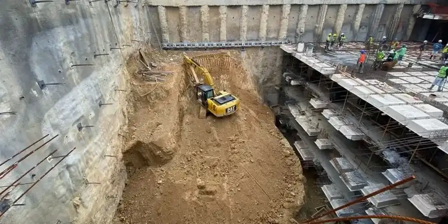
Site-specific factors
ASCE 7-22 Section 12.13 requires that earth-retaining structures resist seismic earth pressures, and in Shreveport—where the mapped spectral accelerations are non-trivial for a mid-continent city—this isn’t a checkbox exercise. A deep excavation that ignores the cyclic degradation of clay strength during a moderate earthquake can undergo permanent lateral displacement that damages adjacent utilities and foundations. The IBC further mandates a review of global stability for excavations deeper than 20 feet, something the local geology demands even at shallower depths when a slope faces the river. We incorporate the Seed-Whitman approach for seismic earth pressure coefficients and run post-earthquake deformation analyses to verify that the shoring system retains serviceability, not just life safety. Overlooking this step in Shreveport can turn a straightforward excavation into a litigation trigger.
Standards used
ASCE 7-22 Minimum Design Loads and Associated Criteria for Buildings and Other Structures, IBC 2021 International Building Code, ASTM D1586 Standard Test Method for Standard Penetration Test (SPT) and Split-Barrel Sampling of Soils, ASTM D2487 Standard Practice for Classification of Soils for Engineering Purposes (Unified Soil Classification System)
Complementary services
Shoring System Design
We engineer soldier pile and lagging, secant pile, and diaphragm wall systems for cuts up to 85 feet, accounting for Caddo Parish’s stiff clay relaxation behavior and sand lens groundwater.
Dewatering and Groundwater Control
Design of deep well and wellpoint systems based on packer test data and pumping test analysis, critical for Shreveport excavations near Cross Lake and the Red River alluvium.
Tieback Anchor Design
We design and proof-test tieback anchors in the overconsolidated clays that dominate Shreveport’s subgrade, verifying creep compliance under sustained lock-off loads.
Excavation Monitoring and Instrumentation
Real-time inclinometer and piezometer monitoring programs that track lateral movement and pore pressure during construction, enabling data-driven decisions on the Shreveport jobsite.
Typical parameters
FAQ
How much does a geotechnical design for a deep excavation in Shreveport typically cost?
For a typical commercial excavation in Shreveport, the geotechnical design phase ranges from US$1,990 to US$7,360, depending on the depth, shoring complexity, and the extent of instrumentation specified. Projects requiring 3D finite element analysis or complex tieback layouts will fall toward the upper end of that range.
What triggers the requirement for a deep excavation design under the IBC?
Any excavation deeper than 20 feet requires a rational analysis per IBC Chapter 33. However, in Shreveport’s stiff clay formations, we often recommend a designed shoring system for cuts as shallow as 12 feet if they are adjacent to existing structures or public rights-of-way, because the delayed relaxation failures can occur without visible warning.
How do you verify tieback anchor capacity in Shreveport’s soils?
We follow ASTM procedures for performance and proof testing, loading each anchor to 133% of the design load and monitoring creep over a 10-minute hold period. The overconsolidated clays in Caddo Parish can exhibit creep at sustained high loads, so we specify a maximum creep rate of 0.04 inches per log cycle of time to confirm the bonded length is adequate.
What dewatering approach works best near the Red River?
Proximity to the Red River means we are often dealing with highly permeable sand lenses that can deliver substantial inflow. We typically design a combination of deep wells to lower the regional water table and a low-permeability cutoff wall if the excavation goes below river stage. The final design is always calibrated with field permeability test data, not just grain-size correlations.