Shreveport excavation projects operate under the IBC Chapter 33 and OSHA Subpart P framework, which demand continuous observation when cuts exceed 5 feet in unstable material. The Red River alluvium that underlies much of the city creates variable conditions—stiff Pleistocene clays transition abruptly into loose sands where groundwater appears at 8 to 12 feet. This geological boundary is notorious along the Cross Bayou corridor and the industrial districts near the port. Monitoring programs here must capture lateral deflection, vibration from adjacent traffic on I-20, and pore pressure shifts that precede base heave. The field team uses automated total stations paired with in-place inclinometers to track wall movement against pre-excavation baselines, generating real-time alerts when deformation rates approach 0.25 inches per shift. For deep utility installations in the sandy deposits south of downtown, combining observation data with a CPT test provides continuous soil behavior profiling that complements the discrete readings from inclinometer casings.
When inclinometer data shows cumulative deflection exceeding half the design allowance, trigger protocols require immediate backfill of the affected zone until the shoring design can be reassessed.
Process and scope
Site-specific factors
Shreveport's development pattern—shifting from low-rise brick warehouses along the riverfront in the early 1900s to modern steel-frame commercial buildings near Youree Drive—has left a legacy of unknown fill and abandoned utility corridors that complicate excavation monitoring. Old clay tile drains and undocumented backfilled cisterns create voids that inclinometers can miss entirely if casing installation doesn't penetrate deep enough. The biggest risk on a Shreveport site is differential settlement at the boundary between natural Pleistocene clay and man-made fill, where a monitored point on the shoring wall may show minimal movement while a building corner 15 feet away settles an inch in a single rain event. The monitoring contractor must therefore maintain a dense surface settlement array—typically 10-foot grid spacing in critical zones—and cross-reference settlement data with rainfall records and piezometric levels before declaring a cut stable. A responsible monitoring program won't just collect data; it interprets patterns against the known behavior of Caddo Parish soils and shuts down excavation when the correlation suggests an impending failure.
Standards used
IBC Chapter 33: Safeguards During Construction, OSHA 29 CFR 1926 Subpart P: Excavations, ASCE 7-22: Minimum Design Loads, ASTM D6230: Monitoring of Ground Movement Using Probe-Type Inclinometers, ASTM D7299: Verifying Vertical Deformation Measuring Devices
Complementary services
Automated Deformation and Vibration Monitoring
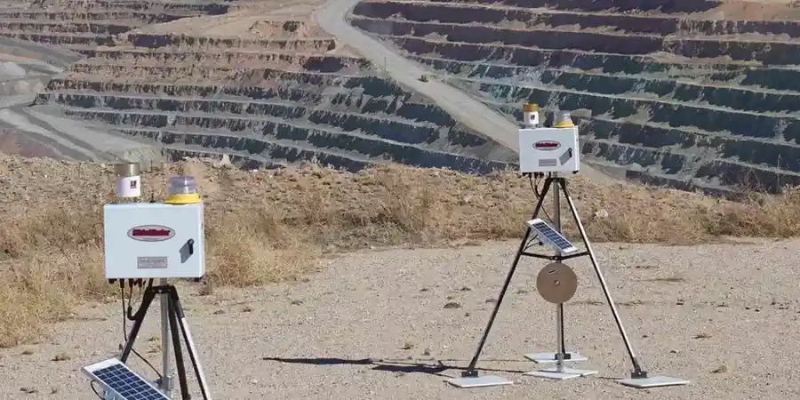
Continuous tracking of lateral wall movement using in-place inclinometers and robotic total stations, supplemented with seismographs to measure construction vibration against ISEE limits at adjacent historic structures.
Groundwater and Settlement Observation
Installation of vibrating wire piezometers and surface settlement points on a dense grid, with daily correlation analysis between rainfall events, pore pressure changes, and vertical movement at the excavation perimeter.
Typical parameters
FAQ
What triggers a stop-work order during excavation monitoring in Shreveport?
Stop-work is triggered when lateral deformation exceeds 80 percent of the design allowance specified in the shoring engineer's submittal, when vibration levels surpass 0.5 inches per second peak particle velocity at the nearest off-site structure, or when a settlement point shows more than 0.25 inches of movement in a single 24-hour period without a corresponding explanation from piezometer data. In practice, the monitoring technician on site has authority to halt excavation immediately and notify the engineer of record.
How does the Red River alluvium affect monitoring instrumentation choices?
The loose saturated sands of the Red River alluvium create challenges for inclinometer casing installation because boreholes can collapse before the casing is grouted. The field team typically uses hollow-stem auger methods to advance the hole and places the casing immediately behind the auger. In these soils, vibrating wire piezometers are preferred over standpipe types because they respond faster to pore pressure changes, which is critical when excavating below the water table in sandy ground that can liquefy under vibration.
What is the cost range for geotechnical excavation monitoring in Shreveport?
Monitoring programs in the Shreveport area typically fall between US$890 and US$2.660 depending on the duration of excavation, the number of instrumented sections, and the reporting frequency required. A small utility trench with two inclinometer casings and five survey prisms monitored for two weeks occupies the lower end, while a multi-level basement excavation with automated total stations, piezometers, crackmeters, and daily engineering review over a two-month period approaches the upper end.
How often are monitoring reports submitted to the city or design engineer?
Daily summary reports with plotted deformation versus time curves go to the contractor and shoring engineer by 8 AM the following morning. A weekly engineering review report compiles all instrument readings, correlates them with construction activity and weather data, and provides a written assessment of trend stability. If any reading exceeds 70 percent of the allowable limit, an immediate notification is sent before the end of the working day.